|
Find the coordinates at a given distance and bearing
Bob from Australia [4 posts] |
12 year
|
I need to find the GPS Longitude and latitude of the Target.
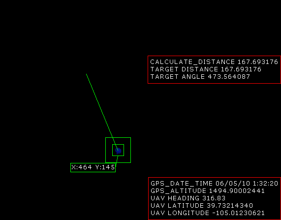
I have my current GPS position ,have calculated the Compass heading to target and Distance to target as shown in attached example.
In Roborealm based on the information I have how can I now display the GPS position of the Target in Roborealm Thanks.

|
|
|
|
Anonymous |
12 year
|
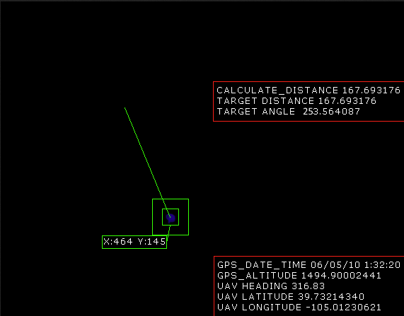
I attached wrong image the compass heading was wrong.Can anyone help out.

|
|
|
|
Carl from Your Country [1447 posts] |
12 year
|
Bob,
Its a bit tricky unless you make some very large assumptions. For example, you have altitude from your GPS but this altitude is relative to sea level and NOT to the ground that you are above. What some do is to take a reading at takeoff and then just assume a VERY flat area that they are flying over. If this isn't the case, you'll need to know the height of the ground that you are currently over in order to solve a trig calculation of height, camera field of view (angle) and distance (opposite side). As in the sin(angle) = distance / height or distance = sin(angle) / height
You would solve this for X and Y and then add the result to the current GPS coordinates ...
The angle in question can be determined by assuming the image width and height as the full field of view (depends on the camera lens which can range between 40 and 80 degrees for typical cameras) and scaling the FOV angle by the X and Y distance of the target to center of screen. This will give you a smaller angle than the FOV unless your target is at the edge of the image. Using this angle in the above formula will give you the answer you need ASSUMING:
1. Your altitude is relative to the ground below and not sea level
2. Your camera is pointed perfectly down such that the center of the image is right below the AUV.
3. The AUV is NOT experiencing any tilt or pitch during the time, i.e. the AUV plane is the same as the ground plane. If not, this simple case fails (i.e. the camera is no longer perpendicular to the ground.
4. Your altitude units are the same as the Lat/Long units.
Note, we are not AUV experts (I've probably made some very gross assumptions that I didn't mention) so the above is a best guess at what we'd try in a simplistic case. I'd instead recommend browsing diydrones.com which deals with this more than we do. For example, see
http://diydrones.com/forum/topics/calculating-ground-gps-coordinates-of-photo-taken-from-uav
which is similar to your question.
STeven.
|
|