|
Pothole detect
Farid from Indonesia [4 posts] |
10 year
|
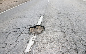
Hi, Mr. Steven. Can you give me example to detect pothole and crack size? Roborealm is very new to me and it would be awesome if you can help. I attach some picture.
Is it possible to get dimention and width of pothole and crack in pixel?
Thank you very much.
 
|
|
|
|
Farid from Indonesia [4 posts] |
10 year
|
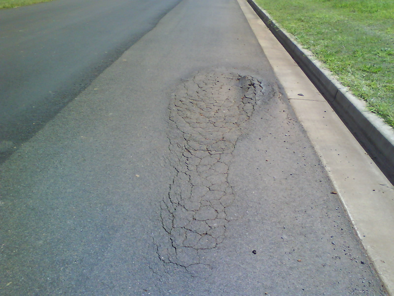
I wonder why no one replied. Anyway, i already tried but it seems to only work for this picture. Can anyone suggest me the best practice to detect various size and form of potholes, please?
Good advice is appreciated..

|
|
|
|
Carl from Your Country [1447 posts] |
10 year
|
Farid,
While it may be possible to classify 'potholes' using just vision alone it will take 1000's of such images to do so. That's quite a project to put together the annotated data in order to train a system to recognize pot holes. Due to the variety of road types there isn't going to be an easy sequence of modules to reliably detect all potholes in different images.
What I would instead do (unless you are interested in a research oriented project) would be to investigate what 3D possibilities you can use instead. Its not uncommon for road based robots to avoid depression obstacles (i.e. potholes) based on 3D analysis of the scene in front of the vehicle. If you have 3D information, understanding the ground plane will allow you to not only detect obstacles such as cones but also potholes. This is normally the way this is done.
Unfortunately, these techniques rely on sensors like Lidars which can be very costly. The less costly alternatives only work indoors due to the use of IR as a projection system. You could try stereo which would probably work well for potholes since they are typically quite textured but you'd only detect deep ones unless you have a huge amount of computing power to analyze high resolution images.
What you are asking for is not easy ...
STeven.
|
|
|
|
Farid from Indonesia [4 posts] |
10 year
|
I see. If i use stereo image. What kind that you recommend? What about this one from https://www.stereolabs.com/? Can i use it with Roborealm? Or, is it better for me to use 2 cameras and use stereo module?
If i took the collecting potholes photos methode, could you explain steps that i need to take? Thank you.
|
|
|
|
Carl from Your Country [1447 posts] |
10 year
|
Its better to purchase a calibrated system than using two cameras. Their solution seems quite good but I would ask them if they could take a depth map of a road with potholes. Their depth images seem quite good but there only a limited number of them to see. They also have some small distortions where shadows meet the road which would concern me when attempting to detect potholes ... but that might just be when they first recorded those scenes. Best to ask for a quick test.
For your own tests, grab your camera (or phone) take a picture of a pothole, hold the camera stable and just lean a little to the left or right and take another picture. It doesn't take much to take a stereo image so don't lean too far!
Post that picture here and we can test to see how well it does using the stereo module. We typically take stereo images using this technique and have good results. Its not how you would eventually use the system but sufficient for testing.
If you prefer the single image method, that boils down to a classification project. I.e. you would need to take/find about 1000 images of potholes and annotate each image (while keeping the source) as to pothole or not. (i.e. create a mask image that when overlaid with the source would overlap with the pothole). Once this huge database is created (VERY time consuming) one can run a automated system over that database (pick whatever machine learning technique you want ... neural nets, SVM, genetic, etc.) to essentially learn what texture/color/shapes/etc. constitute a pothole. This is not unlike how face detection systems are created.
The specific technique used is not as important as gathering the database on which to test. That's the actual value in a project like this since there are many well established learning techniques out there but no annotated pothole database that I'm aware of ... perhaps you can try to see if some University has already done this?
You need many images since you want to be sure that the learning technique learns characteristics about a pothole as apposed to some other unknown attribute that you are not aware of. I.e. if you only use a single image of a pothole to teach a system it could just as easily assume all images that contain gray stuff are of potholes ... which isn't the case!
STeven.
|
|
|
|
Malcolm Kynoch from Canada [3 posts] |
10 year
|
I was wondering would a lidar/laser scanner be a more effective approach? I could provide a vertical profile of at least the undamaged section of road, deep cracks and deep holes would return little or nothing.
Regards,
|
|
|
|
Malcolm Kynoch from Canada [3 posts] |
10 year
|
|
Doh, i missed the earlier mention of the lidar, my bad
|
|
|
|
Carl from Your Country [1447 posts] |
10 year
|
Yes, a lidar would be the best tool for this. The precision offered by a lidar will detect the pothole depressions. In fact, you will get very detailed elevation information and would then need to process that in order to determine which potholes are deep enough to be considered potholes.
STeven.
|
|
 |
Aman Rana from United States [37 posts] |
10 year
|
|
I think if we can use line laser and then process that line made by laser on ground will be promising way to deal with this problem of pothole. As hole will come then line will be segregated in more than one segment that will lead us to a point where pit size and depth based on Y axis displacement can be measured. Just an idea. Keep updating. Nice idea.
|
|
|
|
Farid from Indonesia [4 posts] |
10 year
|
|
Line laser? Can you explain more to me, please? Is it possible to use it under outdoor sunlight?
|
|
|
|
Aman Rana from United States [37 posts] |
10 year
|
|
Sure. assuming you have asphate road which is black in color or any line color which is visible red might not work on soil as soil has reddish color. then u have to choose either blue or any other color which is visible. Let put red laser straight at 90 angle on road and install camera at 45 or less angle. When pothole show up that red laser line on ground will split in 3 or more segments where middle segment of laser line will loose its Y axis in comparison to corner segments. So u can apply red color filters to isolate blobs and process red blobs if blob numbers are more than 2 that mean u have pit hole and use VBscript to log its presence with time andGPS coordinates. length of second Blob which represents pothole size lower on Y axis. I hope this will help u to lead further.
|
|